
Walk a Greeley Street by Address
The address workflow should move from a stable parcel clue to a dated person clue. Begin with the street line in the Weld Property Search. Open the account, copy the parcel and legal description, and note both the property or situs address and the owner's mailing address. Use the GIS map to check the parcel's shape and neighbors. Then carry the legal description or reception number to EagleWeb. A voter lookup can confirm a person only when the searcher has the required identity fields, while a historic reverse directory can show an occupant in a particular year. A Greeley street directory is strongest when the address and record date stay visible together.
Use the steps in order because a city-name search is not a street roll. An owner may hold more than one parcel. A street may include public or exempt parcels, businesses, vacant land, and addresses whose mailing city differs from the municipal boundary. The result is a chain of records, not a claim that one person occupies every unit.
- Enter an address fragment, account, parcel, subdivision, section-township-range, or API number in the Weld Property Search.
- Open the account report and copy the account, parcel, owner, situs location, mailing address, subdivision, block, lot, and legal description.
- Open the Weld GIS Property Map, identify the parcel, and inspect the relevant zoning, precinct, road, flood, or land-use layer.
- Search the Weld EagleWeb recorder index by reception number, grantor, grantee, date, document type, or legal description.
- Use the voter, court, code, permit, or historic-directory source only for the narrower question that source can answer.
When several accounts share a street number, compare subdivision, block, lot, unit, and parcel fields before following a person name. A street directory built from the wrong account can look precise while describing a different tract.
Note: Preserve the exact street suffix, directional, block, and lot wording before trying a modern spelling.
That small record check protects the rest of the address trail.
Greeley Street Directory Search Fields
Weld's public assessor portal uses one search box rather than separate address fields on its basic screen. The Help text accepts examples such as an address, an account beginning with R, or a name. Results can be sorted and opened by account. When a broad search returns several tabs, select the Address or Subdivision result rather than guessing from the owner name.
| Search mode | Entry and use |
|---|---|
| Account | Enter an exact account such as R0355194. |
| Owner name | Try the recorded owner and spelling variants. |
| Address | Use part of a street line such as 1150 O St Greeley. |
| Subdivision | Use subdivision, block, and lot where a street number is uncertain. |
| Parcel number | Enter at least the leading parcel digits shown in Help. |
| Section, township, range | Use the three land-description numbers in the portal's order. |
| API number | Use the full oil and gas parcel identifier when applicable. |
A whole-street review needs one account at a time. Record the account and parcel for each address, then compare the street line with the legal description. The assessor's Greeley inspection returned 88 address records from a broad city query, which shows why a city-name search cannot stand in for a street list. Public parcels, exempt accounts, entities, and multiple units can sit beside private homes.
For an address that appears in a court, voter, or foreclosure record, use the ZIP only as a matching clue. The voter form uses ZIP as an identity field, the foreclosure search has a ZIP filter, and USPS verifies the delivery label. None of those tools replaces the parcel account. This layered approach keeps the Greeley street directory tied to the correct lot and record date.
The Weld full property report example shows the account's document-history, owner, location, building, value, and tax sections.
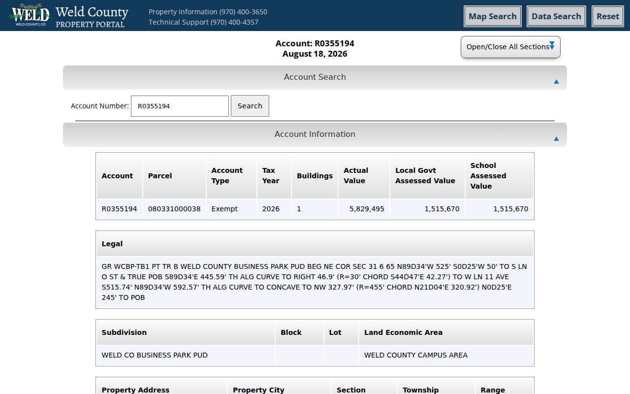
The report's sample owner is Weld County, which makes the distinction plain. A mailing line belongs to the owner record; the property address is the physical parcel. For a private account, the same separation applies.
Three Greeley Address Terms Matter
An address result can contain several location concepts. Treating them as synonyms creates false links between a parcel and a person. Keep the original labels when copying a report.
- Situs address
- The physical location of the parcel, used by the assessor, GIS, permits, and code cases.
- Mailing address
- The address used for owner notices; it may be outside the parcel or outside Greeley.
- Legal description
- The durable land description, such as subdivision, block, lot, section, township, range, or metes and bounds.
- Parcel
- A mapped tax unit with an account and legal boundaries, not a list of every household member.
USPS adds a fifth layer: delivery geography. The postal city and ZIP can differ from the city-limit line. Verify the delivery address with USPS, then use GIS for the municipal or county boundary.
Greeley Street GIS Layers
The Weld GIS viewer is the map bridge between an address and its parcel context. Select a parcel to open information in the left sidebar, then follow the account or property link where available. Theme choices include zoning, land use, election, precinct, floodplain, oil and gas, roads, road maintenance, emissions, and enterprise zone context. The layer can explain why two nearby addresses belong to different jurisdictions or planning areas.
The Weld GIS help page names separate contacts for parcel and owner questions, roads, planning, and GIS data. Its support route is useful when a map layer is hard to read or a downloadable dataset is needed.
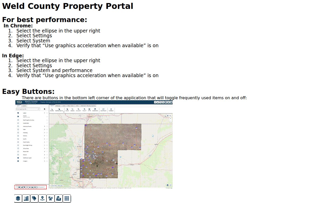
The screenshot shows why the GIS map is a context tool. It can locate parcels, roads, and planning layers, but it cannot prove who is physically inside a building or who receives mail there. The Greeley street directory uses that map for geography, not for a household claim.
Greeley Street Owner Report
For a defined block or radius, Weld's surrounding-property-owner instructions document a repeatable workflow. In the GIS map, choose Identify Point, click the parcel, open the parcel information, select the blue Buffer control, continue with the distance at 500 feet, wait for the operation, and choose Run Report. A PDF link opens a report that outlines the buffer and lists the surrounding parcels for the application.
This is stronger than eyeballing a map because the distance and report date are known. It is still an owner report. It does not list unlisted occupants, household members, utility customers, delivery recipients, protected addresses, or every person using a building. Keep the PDF date with the research note because parcel ownership changes.
Trace the Greeley Deed Chain Along a Street
Use the assessor's legal description or reception link to move into the recorder index. Search the latest instrument, then read the grantee as the likely acquisition party and search that name backward as a grantor. Continue with the prior seller as a grantee. Reception number, recording date, document type, legal description, and related-document links keep the chain anchored when names repeat.
The Weld recorder search help explains Basic last-name-first searches, Advanced order-insensitive searches, wildcards, plus and minus terms, exact date ranges, subdivision block and lot filters, and Find Related. Use both name modes and spelling variants. A blank result can reflect indexing limits, a hard-to-read image, or a different legal description.
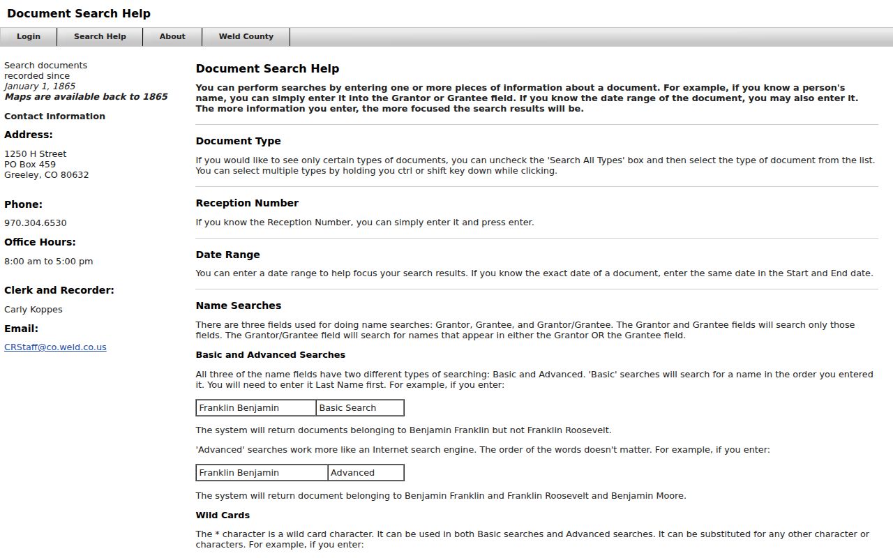
The help screen is the practical difference between a name-only search and a parcel-based search. A deed, deed of trust, release, plat, and correction filing can all touch the same street without representing the same transfer of possession.
Note: An EagleWeb index entry is not the underlying deed image; order or inspect the document when the instrument itself matters.
Greeley Permits and Code Cases by Address
Greeley eTRAKiT exposes modules for permits, projects, properties, inspections, licenses, violations, contractor searches, CRM, and maps. Some public search routes redirected to login during inspection, so treat the landing page as a route to an address-keyed record rather than a guaranteed open index. A permit applicant or contractor is not automatically the owner or occupant.
The public Code Compliance table is more direct for its narrow subject. Visible columns include case number, property address, owner, and date designated. An inspected row showed PN2310-0001 at 715 20th Street with King, Verle and a December 8, 2023 designation; another showed PN2603-0001 at 2495 28th St with D Greeley LLC and a March 6, 2026 date. These are formal chronic-nuisance designations, not every complaint or every person at the address.
Use the Greeley Code Compliance table for the visible case fields, and contact the city department when a current permit or project record is needed.
Greeley Street-Keyed Record Coverage
The Greeley street directory is strongest when each source is used for its own field. The table below separates the clue a source supplies from the conclusion it cannot support. A complete street directory is built parcel by parcel.
| Source | Key fields | Person clue | Limit |
|---|---|---|---|
| Assessor search | Address, account, parcel, owner, location | Owner of record and mailing line | Not current occupant |
| Full parcel report | Legal description, history, tax, building | Recorded transaction and parcel context | Fields can be dated |
| GIS parcel | Geometry, layers, buffer | Adjacent-owner route | No household data |
| Recorder index | Parties, reception, date, document | Title-chain names | Not actual possession |
| Code table | Case, address, owner, date | Dated responsible-party clue | Only formal cases shown |
| Historic reverse directory | Address and occupant by year | Past household lead | Not modern ownership |
Historic Reverse Directories on Greeley Streets
Older Greeley city directories can be searched from a street as well as from a name. The 1871 Rocky Mountain Directory records residence and occupation. The 1892 F.C. Messinger volume, the April 1903 Tribune directory, and the generally annual Greeley City and Rural Route directories can connect an occupant to a named street in a dated year. WCMI and LINC provide finding aids, while the physical volume or scan is the authority for the entry.
A reverse or criss-cross section puts streets in order, then the name section confirms the person. Pair the address with a newspaper, census, obituary, school annual, or cemetery record. Do not assume a directory occupant owned the parcel. The Greeley city directory collections page carries the year and repository details; the street directory angle stays focused on using an address as the starting clue.
What a Greeley Street Directory Cannot Show
A property record cannot reliably identify non-owner occupants, unlisted household members, utility customers, delivery recipients, protected voters, DMV addresses, or private association members. Colorado's Driver's Privacy Protection Act limits motor-vehicle address use. A voter record has public and confidential fields, and the public lookup is not a browse-by-street export.
Use an official custodian for a correction or a lawful records request. Use respectful direct contact for a reunion or family connection. A name match from a deed, code case, docket, or directory should be checked against its date, location, and record purpose before it is repeated.